The South Bay looks continuous at street level, with homes, shopping centers, schools, offices and industrial buildings lining one block after another along the same network of streets. A property map divides that familiar landscape into separately owned parcels, most of which already contain a building or serve an established use.
New housing still appears within this pattern. An owner can replace one house, a developed property can hold more homes, and a few adjoining parcels can become one project. Each adds new construction inside a city whose streets, utilities and property lines are already in place, and because the opportunities are scattered, the finished homes are scattered too. That is why newer construction can remain hard to find even while individual projects keep appearing.
From the street, a replacement house and a newly built neighborhood both look like new construction. On a parcel map, however, they begin with completely different conditions. A whole community must accommodate homes alongside an internal street network, sitewide utilities, stormwater systems and shared spaces. Planning all of that together takes enough connected land to hold the pieces in one place. A city can identify many sites capable of holding additional homes and still have almost nowhere to lay out a neighborhood. The housing inventories prepared by South Bay cities show why the ordinary parcel map rarely supplies that kind of land.
A new home or building fits within an established block.
Adjoining properties become one infill development site.
The site has room to plan homes and internal systems together.
Conceptual diagrams only. Not parcel maps, and not the Ponte Vista site plan.
Fifty-four parcels, nine sites
When Lomita prepared its housing inventory, county assessor data identified 54 parcels as vacant. City staff then examined the properties individually, and only nine qualified as vacant, developable sites. The other entries included rights-of-way, parking lots, irregular pieces of land behind other properties and sites without direct street access. The assessor's label described how a parcel appeared in a database, while building homes required usable dimensions, access from a street and a land-use designation that allowed housing.
The nine sites had a combined realistic capacity of 26 homes in a city of approximately 980 acres that describes itself as almost entirely built out. Twenty-six additional homes would be meaningful in a city as small as Lomita, but these small, scattered sites do not provide the connected land needed for a whole neighborhood. To make a larger site, planners and builders have to look to adjoining properties.
Two to six parcels at a time
Parcel assembly means buying or controlling neighboring properties so they can be developed as one site. Torrance uses the method often enough to document it in detail. Its adopted Housing Element identified 331 housing-inventory sites smaller than half an acre and grouped 303 of them into 86 possible assemblies. The city also documented projects where assembly had already worked: since 2013, 12 projects had each joined between two and six parcels. Torrance described consolidation as a recurring practice and adopted measures to make future assemblies easier.1
Combining several lots can create enough room for townhomes, apartments or a mixed-use building, and Torrance's record shows the method working a few parcels at a time. An assembled project uses the streets already surrounding it and grows as adjoining properties are added.
Planning a community of hundreds of homes introduces another scale. A new street network must reach each section, sitewide systems have to handle water, sewage, utilities and storm runoff, and the plan has to reserve land for parks and other shared spaces. So where does land measured in connected acres come from?
Where connected acres come from
In Hawthorne, former Los Angeles Air Force Base property supplied the land for ThreeSixty South Bay. The military had held and used the property as a single site, so once that use ended, the land could support a coordinated residential plan instead of being assembled from ordinary neighborhood parcels.2
Rolling Hills Estates offers a different example. There, the site combined former sand-and-gravel property with Rolling Hills Country Club land, and the plan added 114 single-family homes while reconfiguring the golf course and adding a new clubhouse, streets, parks and open space.3 The golf course remained, and its reconfiguration created room for housing and new facilities within one plan.
The two developments differ in setting, housing and design, but each began with a substantial property held in one piece under a long-standing use. Military bases, quarries and country clubs can occupy large undivided properties for decades. When those uses change, connected acreage enters the planning process all at once. Redevelopment can still require removing old structures, working with the terrain, adapting existing facilities and completing years of public review. The basic advantage is that the land is already connected.
San Pedro's opportunity lay along Western Avenue, on the site of a former Navy housing neighborhood.
The Navy property on Western Avenue
For decades, the Navy operated 245 residences and supporting buildings on approximately 61.5 acres beside Western Avenue. The homes shared one owner, one street system and one institutional purpose, and that long tenure kept the property intact while much of the surrounding South Bay developed in smaller pieces. By 1999, the housing had been vacated.4
The closure left San Pedro with a 61.5-acre property still held together as one site, along with the former residences, foundations, streets and utility systems. Years of demolition, planning and site work stood between the Navy neighborhood and any future use.
Private ownership brought the first major redevelopment proposal in 2005, a plan for 2,300 homes whose scale prompted years of environmental review, public hearings and revisions. Los Angeles approved a much smaller Ponte Vista Specific Plan in 2014, allowing up to 700 homes and including a 2.42-acre publicly accessible park. That reduction shows how much the plan changed between the opening proposal and the approval.4
A Specific Plan sets development rules for one defined area. At Ponte Vista, it set out what could be built and where, and how many homes were allowed, before individual builders began constructing their home collections. Subdivision maps divided the property for construction, and detailed engineering determined how the streets and building sites would fit the hillside.
The acreage made a community-scale plan possible. Turning that plan into streets and building sites required rebuilding the property as a connected system.
Rebuilding the ground
The new plan had to adapt 61.5 acres of sloping ground for homes and streets. Grading extended across seven planning areas to prepare building sites and establish elevations for the new street network, with some retaining walls reaching roughly 45 feet to hold the reshaped slopes beside roads and homes. Together, the grading and walls created building pads that connect to a common street network at different elevations.5
The new roofs, streets and paved areas also changed how rainwater would move across the property, so storm drains collect and direct the runoff while two underground infiltration galleries and two drywells help treat and absorb it.5 The new infrastructure also included streets, water and sewer pipes, and electrical and communications lines placed underground. Road and utility routes had to follow the new grades and reach each part of the community, and installing those networks during site development allowed later residential phases to connect as construction moved across the property.45
The home collections arrived over several years. Five builders completed seven for-sale collections, while Suncrest became the rental neighborhood. Individual builders brought their own architecture and floor plans to their sections, producing two-story detached homes, three-story detached homes and townhomes that all share the same street network and community spaces.6
This sequence explains how South Bay cities can keep adding homes without routinely producing whole new neighborhoods. Infill places housing within existing blocks, and parcel assembly joins several adjoining properties for a larger project. A whole neighborhood requires a property large enough for its own internal systems, followed by review, engineering and years of construction.
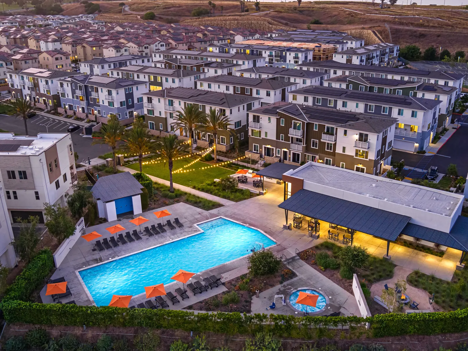
For anyone looking for a newer home, this is what makes Ponte Vista unusual. The former Navy property produced a large concentration of homes built during the 2020s, while much of the surrounding market adds new construction one property or small infill site at a time. Today, Ponte Vista's 61.5 acres hold homes, streets, a public park, walking paths and recreation areas within one connected neighborhood.
Sources
- City of Torrance, adopted 2021-2029 Housing Element, parcel-size and consolidation discussion, printed pages 126-128. ↩
- City of Hawthorne Housing Element, former Los Angeles Air Force Base housing sites. ↩
- City of Rolling Hills Estates, Chandler Ranch Subdivision and Rolling Hills Country Club project. ↩
- Los Angeles City Planning, Ponte Vista environmental review; Ponte Vista ordinance and Specific Plan; California CEQAnet, 2014 Notice of Determination. ↩
- X Engineering, Ponte Vista residential project. Engineering details are limited to the work documented in the project record. ↩
- Rancho Palos Verdes, December 2025 Border Issues Status Report; Meritage Homes, Cabrilla at Ponte Vista; RC Homes, The Heights at Ponte Vista; Suncrest at Ponte Vista. Collection and home-type details were reconciled against the ownership builders' published materials. ↩